Illustrated geography encyclopedias make it easier to understand continents, countries, landforms, climates, and cultures through maps, diagrams, and vivid images.
Whether you are shopping for a child, a home library, or a classroom shelf, the right book depends on age, depth, and how much visual detail you want.
Best 10 Illustrated Geography Encyclopedias Picks for 2026
Visual Earth Guide
Geography: A Visual Encyclopedia
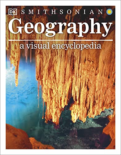
- Stunning color images and annotated artwork
- Maps plus continent and country fact files
- Covers landforms, climate, and natural hazards
Best For: Kids who like broad, picture-heavy geography references
Earth Explorer Pick
Knowledge Encyclopedia Planet Earth!

- CGI cutaways and detailed cross-sections
- Covers volcanoes, glaciers, ecosystems, and climate
- Fact-checked, easy-to-read reference format
Best For: Children ages 9 to 12 who like Earth science visuals
Map-by-Map Choice

- More than 50 full-color maps
- Teaches keys, compass, and scale
- Photos and icons support quick learning
Best For: Young readers learning map skills and world basics
Country Spotlight Pick

- Covers all 196 nations with visual profiles
- More than 1,000 images and full-color maps
- Smithsonian-associated, infographic-style layout
Best For: Kids who want a country-by-country world reference
World-Sized Reference for Students
The Kingfisher Geography Encyclopedia

- 1,500+ photos and country maps
- Quick facts for each country
- Built for ages 10-14 research
Best For: Students and classrooms needing a broad visual geography reference
Kid-Friendly Geography Glossary
Geography: An Illustrated A-Z Glossary

- Over 100 terms in A-Z format
- Colorful hand-drawn illustrations
- Easy index for cross-references
Best For: Young learners and homeschoolers starting geography vocabulary
Atlas-Plus World Reference
The Usborne Internet-Linked Encyclopedia of World Geography

- Physical and human geography coverage
- Complete world atlas included
- Related websites support further research
Best For: Middle-grade readers who want maps plus encyclopedia content
Visual Earth Encyclopedia
Geography: A Visual Encyclopedia of Planet Earth

- Updated edition with latest facts and stats
- Colorful diagrams, maps, and country factfiles
- Covers physical and human geography clearly
Best For: Kids ages 9-12 who want a visual introduction to Earth geography
Updated Student Atlas

- Fully updated 2025 student atlas
- 85 pages of physical and political maps
- Infographics and charts cover key geography topics
Best For: Grades 6-12 students needing a visual atlas reference
Flag Reference Volume
The World Encyclopedia of Flags

- 1,400 color illustrations across a wide survey
- Covers flag history and current use worldwide
- Includes countries, territories, organizations, and causes
Best For: Flag enthusiasts and readers interested in the political symbolism of geography
Visual Earth Guide – Geography: A Visual Encyclopedia
If you want illustrated geography encyclopedias that make Earth feel vivid and approachable, this DK volume is built around striking photos, annotated artwork, maps, and fast facts. It covers everything from natural wonders and landforms to climate events and world regions, giving young readers a broad visual tour of the planet in one large reference book.
Best For: Kids ages 6 to 12 who learn best from rich visuals, maps, and short fact-packed sections.
Pros:
- Hundreds of pages of color images, annotated artworks, and packed profiles
- Includes physical and political maps plus continent and country fact files
- Covers key Earth topics like earthquakes, tsunamis, ice ages, and global warming
- Age-appropriate for grades 3 to 7 with a wide 6 to 12 reading range
Cons:
- More of a broad visual reference than a deep, topic-specific atlas
- The 304-page format may feel substantial for newer independent readers
This is a strong pick if you want an illustrated geography encyclopedia that balances eye-catching presentation with practical earth-science and world-geography content. It is especially useful for children who like to explore by looking, comparing, and browsing rather than reading straight through.
Earth Explorer Pick – Knowledge Encyclopedia Planet Earth!
Knowledge Encyclopedia Planet Earth!: Our Exciting World As You've Never Seen It Before
Check Price On AmazonFor families shopping illustrated geography encyclopedias with a strong science angle, this DK title stands out for its CGI visuals, cutaways, and clearly explained Earth topics. It is designed to help children understand how the planet works through detailed imagery and easy-to-read text, with coverage of everything from volcanoes and hurricanes to glaciers and climate change.
Best For: Ages 9 to 12 who enjoy detailed visual explanations of Earth science and geography.
Pros:
- Ground-breaking CGI imagery and detailed cross-sections
- Includes facts, charts, timelines, illustrations, and photographs
- Fact-checked by subject experts for accuracy
- Breaks down big topics like mountains, ecosystems, and climate in clear language
Cons:
- Focused more on Earth systems than on country-by-country geography
- The visual style may appeal most to readers who like science-heavy reference books
This is a smart choice if you want a geography encyclopedia that also teaches how Earth functions, not just where things are on a map. The combination of polished visuals and straightforward explanations makes it easy to browse in short sessions or use as a home learning reference.
Map-by-Map Choice – Children's Illustrated Atlas
If you are looking for illustrated geography encyclopedias that focus on map reading and country awareness, this revised DK atlas is a practical choice. It combines more than 50 specially commissioned maps with colorful icons, photos, and bite-sized facts, helping children learn about countries, continents, climates, and natural features in a structured way.
Best For: Ages 7 to 9 who are starting to learn how to read maps and understand world regions.
Pros:
- More than 50 maps with full-color country and continent detail
- Teaches map skills such as using a key, compass, and scale
- Includes a world map poster plus political maps for each continent
- Uses photographs, diagrams, and icons to keep information accessible
Cons:
- Shorter than some encyclopedia-style geography books at 128 pages
- Best suited to younger readers rather than older, more advanced students
This atlas is especially useful if you want a visually rich geography book that builds core map skills alongside general world knowledge. It is a good fit for classroom support, homework help, or family browsing with younger children.
Country Spotlight Pick – Countries of the World
Countries of the World: A Visual World Geography Encyclopedia for Kids (DK Our World in Pictures)
Check Price On AmazonAmong illustrated geography encyclopedias, this DK title is a strong country-by-country reference for kids who like facts, maps, and photos all in one place. It profiles all 196 nations with a highly visual layout, combining images, diagrams, and full-color maps to highlight geography, wildlife, traditions, and arts in an accessible format.
Best For: Ages 9 to 12 who want a visual encyclopedia focused on countries and cultures around the world.
Pros:
- Profiles all 196 nations with photos and map-based summaries
- More than 1,000 images create a highly visual learning experience
- Includes diagrams, infographic text boxes, and at-a-glance stat panels
- Built in association with The Smithsonian Institution
Cons:
- More country-focused than a broad, all-topics geography encyclopedia
- The dense amount of visuals and facts may be best for browsing rather than continuous reading
This book is a good pick if your priority is a visual tour of the world’s countries rather than a general Earth overview. Its mix of maps, photos, and concise factual panels makes it easy to dip into for quick learning and comparison.
World-Sized Reference for Students – The Kingfisher Geography Encyclopedia
If you’re comparing illustrated geography encyclopedias for school research, this updated Kingfisher volume is a strong all-in-one reference. It covers the world’s essential physical, cultural, and geopolitical facts in a country-by-country format, with more than 1,500 photographs, commissioned maps, and quick reference panels that make information easy to find.
Best For: Students ages 10-14 who need a visual, comprehensive geography reference for homework, projects, and classroom research.
Pros:
- More than 1,500 photographs add strong visual support to the text.
- Country-by-country layout makes lookup simple and practical.
- Quick reference panels cover key facts like population, currency, language, and major cities.
- Includes maps based on the latest satellite data plus a comprehensive index.
Cons:
- Its size and 4.74-pound weight make it less convenient for casual carry.
- Best suited to student reference use rather than light browsing.
This is a solid pick if you want a visually rich geography encyclopedia that stays organized and research-friendly. It feels especially useful for home libraries and classrooms where students need dependable, easy-to-scan facts about countries around the world.
Kid-Friendly Geography Glossary – Geography: An Illustrated A-Z Glossary
For shoppers looking at illustrated geography encyclopedias for younger readers, this A-Z glossary offers a simple, picture-led introduction to Earth’s landforms and biomes. It covers over 100 geography terms with colorful illustrations, bolded vocabulary, and an easy index that helps kids connect related concepts as they learn.
Best For: Kids who benefit from short definitions, visual learning, and a gentle first introduction to geography vocabulary.
Pros:
- Colorful hand-drawn illustrations support each definition.
- Over 100 geography terms are included in clear, kid-friendly language.
- Bolded terms and a large index make cross-referencing easier.
- Useful for homeschooling, supplementing other books, or gifting to geography fans.
Cons:
- Focused on glossary-style terms rather than broad country-by-country coverage.
- More introductory than comprehensive.
This is a practical choice if you want an approachable geography book that builds vocabulary one term at a time. It’s especially well matched to younger children who learn best from images, short explanations, and repeat exposure to key terms.
Atlas-Plus World Reference – The Usborne Internet-Linked Encyclopedia of World Geography
If you want illustrated geography encyclopedias that combine reference reading with atlas-style lookup, this Usborne edition is a straightforward option. It introduces the physical and human geography of Earth, describes peoples and societies across the continents, and adds a complete world atlas plus related websites for further exploration.
Best For: Middle-grade readers who want a geography encyclopedia with atlas content and web-based follow-up resources.
Pros:
- Covers both physical and human geography.
- Includes a complete world atlas for map-based reference.
- Describes peoples and societies by continent.
- Lists related websites for additional learning.
Cons:
- Publication date is older than some newer geography references.
- Less detail on format and illustration style than some alternatives.
This book is a good fit if you want a compact geography reference that mixes encyclopedia content with atlas material. It should appeal to readers who like moving between text, maps, and internet-linked follow-up research.
Visual Earth Encyclopedia – Geography: A Visual Encyclopedia of Planet Earth
If you want illustrated geography encyclopedias that make big Earth science ideas easy to grasp, this DK Smithsonian title is a strong pick for ages 9-12. It explains physical and human geography with colorful diagrams, maps, and country factfiles, while also covering topics like climate change, earthquakes, tsunamis, the water cycle, and rainforest structure in a clear, visual format.
Best For: Kids ages 9-12 who learn best from colorful diagrams, maps, and bite-sized explanations of Earth science and geography.
Pros:
- Fully updated edition with new design and latest facts and stats
- Wide coverage of physical and human geography, from ice ages to global warming
- Strong visual approach with beautiful pictures and clear diagrams
- Includes maps and country factfiles for broader context
Cons:
- Geared mainly toward children, not older teens or adults
- Best suited to general reference and overview learning rather than deep specialization
This is a practical all-around geography reference for young readers who want a visually rich introduction to how Earth works. It stands out for turning complex processes into accessible, illustrated explanations.
Updated Student Atlas – Atlas of World Geography
For shoppers comparing illustrated geography encyclopedias for school use, this Rand McNally atlas offers a map-heavy, highly visual reference built for secondary students. It combines detailed physical and political maps with illustrations, photography, infographics, graphs, and charts, plus continent sections that cover landforms, climate, population, economics, and current events.
Best For: Grades 6-12 students who need a richly illustrated atlas with maps, charts, and current geography reference material.
Pros:
- Fully updated for 2025 with current country information
- Includes 85 pages of detailed physical and political maps
- Uses infographics, graphs, and charts to expand understanding
- Continent sections add land use, climate, and current event context
Cons:
- More atlas-focused than narrative encyclopedia-style reading
- Best suited to school-age users rather than younger children
This is a strong choice if you want a classroom-friendly atlas that makes geography easy to scan and compare visually. Its mix of maps and data makes it especially useful for students working through world geography topics.
Flag Reference Volume – The World Encyclopedia of Flags
If you are looking for illustrated geography encyclopedias with a more specialized angle, this flag encyclopedia is a detailed visual reference on international flags, banners, standards, and ensigns. It provides 1,400 color illustrations, a historical overview of flags from the 3rd century BC to the 21st century, and a continent-by-continent survey of more than 600 flags currently in use.
Best For: Readers who want a visually rich, specialized reference on flags, identity, and the political side of world geography.
Pros:
- Lavishly illustrated with 1,400 color images
- Covers both the history of flags and flags in current use
- Includes countries, territories, organizations, individuals, and causes
- Offers geographic and political insights in a reference-book format
Cons:
- Narrower focus than a general world geography encyclopedia
- Less useful if you want broad coverage of landforms, climate, or maps
This book works well as a niche companion volume for flag enthusiasts, students, or reference shelves. Its strength is depth: it turns a specific geography topic into a substantial illustrated resource.
How We Picked the Best Illustrated Geography Encyclopedias
We focused on books that combine clear geography coverage with strong visuals, accurate information, and a format that supports real-world use. For Illustrated Geography Encyclopedias, that usually means well-labeled maps, high-quality images, age-appropriate explanations, and a structure that makes topics easy to browse.
We also looked for options that serve different readers, from younger children who need simple explanations to older students who want broader reference value.
Quick Comparison
The best choice depends on how the book will be used. Some titles are better for early learning and visual discovery, while others function more like a compact atlas or a deeper reference book. If you want a broad overview of Earth, choose a general encyclopedia. If your reader prefers facts by topic or region, an atlas-style format may be a better fit.
Key Buying Factors for Illustrated Geography Encyclopedias
Age Range and Reading Level
Check whether the language matches the reader. Younger children benefit from short entries, simple labels, and large visuals. Older readers may prefer denser text, more terminology, and stronger map detail.
Maps, Charts, and Visual Layout
The strongest Illustrated Geography Encyclopedias use visuals to clarify scale, location, and relationships between places. Look for satellite images, relief maps, cross-sections, and infographic-style spreads that explain geographic concepts quickly.
Scope of Coverage
Some books emphasize physical geography such as mountains, rivers, and weather, while others include human geography, countries, flags, and cultures. Pick the balance that fits your goal, whether that is school support, casual browsing, or a broader world overview.
Durability and Usability
For kids and classroom use, sturdy binding, thick pages, and easy navigation matter. A strong table of contents and index also make a big difference when the book is used as a reference.
Who Should Buy Which Illustrated Geography Encyclopedias?
Choose a more visual, child-friendly encyclopedia for elementary-aged readers, especially if they learn best through pictures and simple explanations. Select a fuller atlas or encyclopedia for middle-grade students who need more detail and geography vocabulary. If you want a giftable shelf book or family reference title, look for broader coverage and strong design that works for both browsing and lookup.
For most buyers, the best Illustrated Geography Encyclopedias are the ones that match the reader’s age, curiosity level, and need for visual learning. A well-chosen title should be engaging enough to browse, but structured enough to use again and again.