The best map books do more than show borders and place names. They can explain how geography shaped history, reveal surprising patterns, or provide a dependable reference for school, travel, and everyday curiosity.
We’ve selected 10 standout map books for different readers, from students and atlas shoppers to history enthusiasts and anyone who enjoys seeing the world from a new perspective.
Best 10 Map Books Picks for 2026
Best Illustrated World Atlas

- Lavish illustrations of the entire world
- Combines geography with cultural and natural facts
- Approachable for ages 4 and up
Best For: Families and young readers exploring world geography
Best North American History Reference
History of North America Map by Map

- Traces North American history across 408 pages
- Uses maps, timelines, documents, and artifacts
- Covers prehistory through the 21st century
Best For: Students and readers studying North American history
Best Concise World Atlas
National Geographic Concise Atlas of the World

- More than 250 maps, graphics, and illustrations
- Includes country facts, flags, and a place-name index
- Adds global issues and space-related visuals
Best For: Everyday reference, study, and travel planning
Best Military History Atlas

- Explores 80 famous battles through maps
- Covers ancient to modern warfare
- Adds timelines, commanders, technology, and artifacts
Best For: Military history fans and visual learners
Best Interactive World Atlas
Brilliant Maps for Curious Minds
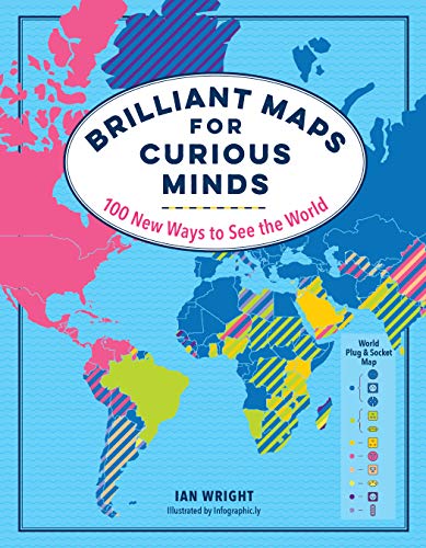
- 100 colorful infographic maps
- Explores surprising global patterns
- Accessible and entertaining format
Best For: Curious readers and casual geography learners
Best for Military History

- More than 100 historical maps
- Covers all major war theaters
- Adds timelines, photos, and profiles
Best For: History students and military-history enthusiasts
Best for Cartographic Mysteries

- Explores myths and errors on maps
- Features richly illustrated antique maps
- Links cartography with exploration and mythology
Best For: Readers fascinated by antique maps and imagined worlds
Best Pocket Reference

- Pocket-sized 4-by-6-inch format
- Updated physical and thematic maps
- Covers climate, population, and hazards
Best For: Portable everyday world reference
Best Story-Driven Pick

- Interactive maps for ages 4 to 8
- Detail-rich neighborhood illustrations
- Thoughtful story about moving and home
Best For: Young readers and families facing a move
Best for Students
Merriam-Webster’s Student Atlas

- Full-color physical and political maps
- Charts, graphs, photos, and glossary
- Includes Earth, climate, and resource topics
Best For: Middle school geography and classroom reference
Best Illustrated World Atlas – Maps
Maps is one of the most inviting map books for readers who want a colorful visual tour of the world. Its lavish illustrations combine geography with cultural, historical, and natural facts, making it suitable for browsing, family reading, or classroom exploration.
Best For: Families, young readers, and anyone who prefers an illustrated introduction to world geography.
Pros:
- Lavishly illustrated maps cover regions around the world.
- Includes cities, rivers, mountains, landmarks, cultural events, animals, and plants.
- Accessible for readers ages 4 and up.
- Large 11-by-14.88-inch format makes the artwork easy to explore.
Cons:
- At 112 pages, it offers less reference depth than a traditional atlas.
- Its illustrated, casual approach may not meet advanced research needs.
This is a visually rich choice when you want map books to entertain as well as teach. Choose it for discovery and shared reading rather than highly technical geographic reference.
Best North American History Reference – History of North America Map by Map
History of North America Map by Map is a substantial pick among map books for readers who want geography to explain historical change. Detailed maps, timelines, documents, artifacts, and explanatory chapters trace the continent from prehistory through the 21st century.
Best For: History students, serious browsers, and readers seeking a chronological visual history of North America.
Pros:
- 408 pages provide broad coverage from prehistory to the 21st century.
- Maps are supported by historical documents, artifacts, and timelines.
- Covers Indigenous civilizations, European arrival, settlement, slavery, and abolition.
- Chronological organization supports both casual browsing and deeper study.
Cons:
- The 5.24-pound format is heavy for portable reading.
- Its detailed historical scope may be more than casual readers need.
For buyers who want map books with genuine historical depth, this 2024 DK volume is a strong fit. Its large format and extensive visual material make it better suited to a desk, coffee table, or home library than travel.
Best Concise World Atlas – National Geographic Concise Atlas of the World
The fifth-edition National Geographic Concise Atlas of the World is a practical reference among map books, pairing more than 250 maps, graphics, and illustrations with country facts, flags, photographs, and a place-name index. It also adds thematic coverage of population, climate, health, economics, and space.
Best For: Students, households, and travelers who want a compact but authoritative world reference.
Pros:
- Includes more than 250 maps, graphics, and illustrations.
- Covers world, continental, U.S., and country-level geography.
- Features data graphics on current global issues.
- Includes maps of the Moon and Mars plus solar-system and universe diagrams.
Cons:
- At 200 pages, it is less expansive than a full-size world atlas.
- The large softcover format may be less durable than a hardcover reference.
This is a balanced choice for everyday geographic lookup and visual learning. The index improves usability, while the space section gives it broader appeal than a strictly terrestrial atlas.
Best Military History Atlas – Battles Map by Map
Battles Map by Map is a focused option among map books for readers who want to understand warfare through terrain and strategy. Eighty maps, timelines, contextual features, and historical images cover famous battles from the ancient world through World War II and beyond.
Best For: Military history enthusiasts, visual learners, and readers interested in how geography shaped famous battles.
Pros:
- Includes 80 easy-to-follow maps of notable battles.
- Chronological timelines help organize ancient, medieval, and modern conflicts.
- Explains commanders, armies, technologies, weapons, and battlefield innovations.
- Combines maps with paintings, photographs, objects, and informative text.
Cons:
- Its military focus is narrower than general world-history map books.
- The nearly four-pound illustrated format is not especially portable.
This DK volume works well when you want battlefield geography connected to tactics, technology, and leadership. It is a strong gift or shelf reference for armchair generals, though readers seeking broader history may prefer a more comprehensive title.
Best Interactive World Atlas – Brilliant Maps for Curious Minds
If you want map books that make geography approachable and surprising, Brilliant Maps for Curious Minds is a lively choice. Its 100 colorful infographic maps answer unusual questions about culture, politics, history, economies, transportation, and wildlife in an accessible format.
Best For: Curious readers, families, and casual geography learners who prefer visual explanations and bite-sized discoveries.
Pros:
- Includes 100 colorful infographic maps.
- Covers varied topics, from female leaders and national economies to McDonald’s locations and wild lions.
- Offers a concise, entertaining way to explore global patterns and connections.
Cons:
- Its broad, infographic-driven approach may not satisfy readers seeking a traditional reference atlas.
- At 208 pages, individual topics receive relatively limited space.
This is an engaging pick when you want map books for browsing, conversation starters, or informal learning rather than a detailed geographical reference.
Best for Military History – World War II Map by Map
For readers seeking map books focused on historical conflict, World War II Map by Map combines more than 100 specially created maps with timelines, archival photographs, artifacts, and explanatory text. It follows the war across land, air, and sea while showing how geography shaped its major campaigns.
Best For: History students, military-history enthusiasts, and readers aged 12 and up who want a visual guide to World War II.
Pros:
- Uses more than 100 maps to cover major theaters of World War II.
- Includes timelines, narrative overviews, photo features, and historical profiles.
- Produced in association with the Smithsonian Institution and guided by historian Richard Overy as consultant.
- Large illustrated format supports detailed visual study.
Cons:
- Its 4.19-pound size makes it less convenient for portable reading.
- The extensive detail may feel demanding for readers seeking a brief overview.
Among map books about war, this is the strongest fit for readers who want geography integrated with chronology and historical context rather than maps alone.
Best for Cartographic Mysteries – The Phantom Atlas
The Phantom Atlas is one of the more unusual map books, exploring how mistakes, myths, misunderstandings, fantasies, and deliberate falsehoods shaped maps. Its richly illustrated accounts examine ghost islands, mythical civilizations, imaginary mountain ranges, sea monsters, and other features that never truly existed.
Best For: Readers interested in antique maps, exploration history, mythology, and the stories behind cartographic errors.
Pros:
- Features a striking collection of real antique maps.
- Connects cartography with exploration, mythology, and colorful historical anecdotes.
- Written by map collector Edward Brooke-Hitching, a Royal Geographical Society Fellow and QI writer.
Cons:
- Focuses on imaginary and mistaken map features rather than practical modern geography.
- Its thematic storytelling may be less suitable for readers seeking a systematic atlas.
This is an excellent choice if you want map books with atmosphere and narrative appeal—especially when the history of how people imagined the world matters as much as the world itself.
Best Pocket Reference – Compact Atlas of the World
For shoppers comparing map books for travel, study, or everyday reference, the National Geographic Compact Atlas of the World, Second Edition packs broad coverage into a pocket-friendly format. Its 4-by-6-inch softcover includes updated world and continental maps along with thematic coverage of climate, population, land cover, fresh water, and natural hazards.
Best For: Travelers, students, and anyone wanting a compact general-purpose world atlas.
Pros:
- Small, lightweight design fits pockets, backpacks, and desks.
- Includes updated physical, world, and continental maps.
- Covers useful themes such as climate, population, and natural hazards.
- National Geographic design emphasizes readability and easy navigation.
Cons:
- The compact dimensions may limit map detail compared with a larger atlas.
- Its broad coverage may be less suitable for readers seeking in-depth regional mapping.
This is a practical choice when portability matters most. It offers a wide range of reference information without the bulk of a full-size atlas.
Best Story-Driven Pick – A Book of Maps for You
Among map books for young readers, A Book of Maps for You stands out as an interactive picture book about place, memory, and moving. A young cartographer leaves behind detailed, annotated maps of neighborhood locations, inviting children to search illustrations for familiar and unexpected details.
Best For: Children ages 4 to 8, families navigating a move, and adults seeking an engaging read-aloud.
Pros:
- Interactive maps encourage close looking and repeat readings.
- Explores both the home a child leaves and the place they are entering.
- Detail-rich illustrations offer plenty to discover.
- Recognized by multiple children’s book lists and organizations.
Cons:
- At 40 pages, it is a picture book rather than a reference atlas.
- The focus is storytelling and exploration, not geographic instruction.
This is a thoughtful choice for children who enjoy illustrated maps and hidden details. Its emotional moving theme also makes it especially relevant during a transition to a new home.
Best for Students – Merriam-Webster’s Student Atlas
Merriam-Webster’s Student Atlas - Features Full-Color Physical, Political, & Thematic Maps
Check Price On AmazonFor families and classrooms choosing map books for school-age learners, Merriam-Webster’s Student Atlas combines full-color physical, political, and thematic maps with photographs, charts, graphs, and country facts. It is designed for middle schoolers and covers landforms, climate, resources, population density, ocean currents, and more.
Best For: Students in approximately grades 5–9, classroom reference, and independent geography study.
Pros:
- Includes physical, political, and thematic map types.
- Explains topics such as Earth and atmosphere layers in the new edition.
- Uses photographs, charts, graphs, and a glossary to support learning.
- Includes flags and facts for countries and territories worldwide.
Cons:
- The content is geared toward students rather than advanced researchers.
- Its 132-page format may provide less depth than a larger reference atlas.
This atlas is a strong school-focused option for readers who need more than political maps. The mix of visuals, statistics, definitions, and thematic subjects supports both classroom assignments and general exploration.
How We Picked These Map Books
We chose titles that offer a clear purpose, strong visual presentation, and useful geographic or historical content. The selection includes traditional atlases, thematic map collections, history-focused references, student-friendly resources, and more interpretive books about how maps influence the way we understand the world.
We also considered coverage, readability, map quality, educational value, and the type of reader each book serves. Because a compact atlas and a richly illustrated history book solve different problems, the best choice depends on how you plan to use it.
Quick Comparison
| Best For | Recommended Type | What to Look For |
|---|---|---|
| General world reference | Comprehensive atlas | Current political, physical, and thematic maps |
| Travel and portability | Compact atlas | Manageable size, clear labeling, and durable binding |
| History enthusiasts | Historical map collection | Chronological context and explanatory text |
| Students | Student atlas | Readable legends, full-color maps, and curriculum-friendly coverage |
| Curious general readers | Thematic or illustrated map book | Unexpected comparisons, stories, and visual variety |
Key Buying Factors for Map Books
Coverage and Purpose
Decide whether you need a reference atlas covering the entire world or a focused book about history, conflict, culture, or unusual geographic ideas. A broad atlas is more versatile, while a specialized title usually offers deeper commentary.
Map Detail and Readability
Check the scale, labeling, legends, color contrast, and page size. Highly detailed maps can be valuable, but crowded typography may be frustrating for casual readers or younger students.
Edition and Currency
For political and statistical information, choose the newest edition available. Historical Map Books are less dependent on current borders, but updated editions may improve captions, image quality, and supplementary material.
Format and Durability
Large hardcover volumes often provide the best viewing experience, while compact editions are easier to store or carry. Consider binding quality if the book will be used frequently by students or travelers.
Who Should Buy Which Map Books?
Choose a comprehensive National Geographic atlas if you want a dependable all-purpose reference. A compact atlas is better for smaller desks, shelves, or travel bags. Students will benefit most from a clearly organized student atlas with physical, political, and thematic coverage.
Readers interested in the past should consider a history or battles map collection, while World War II enthusiasts may prefer a dedicated chronological volume. For unusual facts and visual discoveries, a thematic book such as Brilliant Maps for Curious Minds is a strong fit. Those fascinated by cartographic errors, myths, and imagined places may enjoy The Phantom Atlas.
Finally, prioritize an illustrated or gift-oriented map book when presentation matters as much as reference value. Whichever style you choose, match the book’s depth, size, and subject focus to the reader rather than assuming the largest atlas is automatically the best.