Railroad atlas books are a great way to explore rail history, route development, and regional networks in one place. Whether you want a broad North American overview or a state-by-state reference, the right atlas can be both useful and collectible.
In this roundup, we focus on titles that balance map detail, historical value, and practical reference value for researchers, hobbyists, and railfans.
Best 10 Railroad Atlas Books Picks for 2026
Classic North American rail map reference
Atlas of North American Railroads

- Collected classic system maps from railroad-era sources
- Multi-page spreads include history, specs, and photos
- Focuses on the postwar peak of North American railroads
Best For: Readers who want a visual reference to major North American railroad systems
Global railroad map history
A History of the Railroad in 100 Maps

- 100 maps spanning six continents and many uses
- Chronological format with explanatory historical text
- Covers planning, operations, tourism, and cultural artifacts
Best For: Readers who want an international map-based history of railroads
Detailed North American rail atlas
The Historical Atlas of North American Railroads

- Over 400 maps, plans, and photographs
- Covers networks, technology, and infrastructure
- Includes social history of people and freight movement
Best For: Buyers who want a comprehensive North American rail history atlas
County-by-county Michigan rail reference
Michigan Railroad Atlas Volume 1
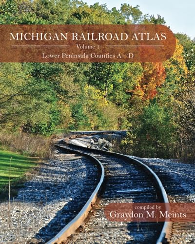
- Detailed maps for Michigan counties and local areas
- Covers common carrier, interurban, logging, and mining roads
- Organized for local research across the Lower Peninsula
Best For: Researchers and enthusiasts focused on Michigan rail history
Historical Reference Atlas
The Routledge Historical Atlas of the American Railroads

- Covers the American railroads in historical context
- 144 pages in a compact reference format
- Published by Routledge in 1999
Best For: Readers wanting a concise overview of U.S. railroad history
Regional Map Atlas
SPV's Comprehensive Railroad Atlas of North America: Mountain Plains

- Covers Montana, Idaho, and Wyoming
- Detailed at 8 miles to 1 inch, with enlarged complex areas
- Includes index, identification marks, and major rail features
Best For: People needing a detailed Mountain Plains rail atlas
London Rail Atlas
London Railway Atlas 6th Edition

- Fully revised sixth edition for London rail coverage
- Includes Underground, DLR, Network Rail, and industrial railways
- Large-format maps show tracks, platforms, and station history
Best For: Enthusiasts needing a detailed London rail network atlas
Comprehensive North American Railroad History
Historical Atlas of the North American Railroad

- Nearly 400 historical maps, mostly in full color
- Covers railroad development from the 1820s to today
- Includes photos, brochures, and posters for context
Best For: Readers seeking a wide historical overview with strong visual material
Large-Format Network Reference
Historical Atlas Of North American Railroads

- Over 400 maps, plans, and photographs
- Tracks network spread, stations, bridges, tunnels, and technology
- Also covers the social role of rail transportation
Best For: Buyers wanting a large, heavily illustrated railroad reference
State-Level Detailed Rail Mapping
A Railroad Atlas of the United States in 1946

- Detailed hand-drawn maps for Illinois, Wisconsin, and Upper Michigan
- Covers stations, yards, interlockings, trackage rights, and more
- Built for cross-referencing with USGS maps and road atlases
Best For: Readers needing a precise postwar Midwestern rail atlas
Classic North American rail map reference – Atlas of North American Railroads
If you want railroad atlas books that focus on the industry at its mid-twentieth-century peak, this volume offers a clear, map-driven look at North American rail coverage. It collects classic system maps from the railroad era, pairing route spreads with historical context, key operating specs, and period photos.
Best For: Readers who want a concise visual history of major North American railroad systems at their postwar peak.
Pros:
- Collects classic system maps from North American railroads in one volume.
- Includes multi-page route spreads with capsule histories and vital specs.
- Features period photographs that add context to the maps.
- Focuses on the railroad industry at its greatest postwar reach.
Cons:
- Limited to North American railroads rather than global coverage.
- At 176 pages, it is more of a focused reference than an exhaustive encyclopedia.
This is a strong pick if you want a visually rich snapshot of classic railroad systems and how they were documented in their peak era.
Global railroad map history – A History of the Railroad in 100 Maps
For railroad atlas books with a broader historical lens, this title traces the spread of railroads through 100 reproduced maps from around the world. It moves chronologically and uses maps from six continents to explain how railroads shaped planning, operations, tourism, and broader political and urban development.
Best For: Readers who want an international, map-based history of railroads and infrastructure.
Pros:
- Features 100 maps with examples from six continents.
- Includes maps used for planning, operations, passengers, shippers, and tourists.
- Arranged chronologically for an easy historical progression.
- Uses explanatory text to connect maps with social and development history.
Cons:
- More history-focused than a practical track-by-track atlas.
- Its broad scope may be less detailed for a single region or railroad.
This is an excellent choice if you want a research-minded overview that treats railroad maps as both historical sources and cultural artifacts.
Detailed North American rail atlas – The Historical Atlas of North American Railroads
If you are comparing railroad atlas books for depth, this updated volume stands out for its large map count and broad coverage of rail transportation. It combines more than 400 maps, plans, and photographs with sections on network expansion, technology, stations, bridges, tunnels, and the social role of railroads.
Best For: Buyers who want a detailed, all-around atlas covering North American rail history and infrastructure.
Pros:
- Includes over 400 maps, plans, and photographs.
- Shows the spread of networks across the country.
- Covers technology, stations, bridges, tunnels, and factories.
- Explores social history, including movement of people and goods.
Cons:
- Focused on North America rather than international rail history.
- At nearly 400 pages, it is larger and heavier than a quick-reference book.
This is the most comprehensive option here if you want a broad visual and historical survey of North American rail transportation.
County-by-county Michigan rail reference – Michigan Railroad Atlas Volume 1
For readers searching railroad atlas books with a regional focus, this Michigan volume provides detailed county maps of a once-vast rail network. It documents common carrier railroads, interurban lines, and even logging and mining roads, making it useful for studying how rail service was laid out across the Lower Peninsula.
Best For: Researchers and enthusiasts focused on Michigan rail history, especially the Lower Peninsula.
Pros:
- Provides detailed railroad maps for each of Michigan’s 83 counties.
- Includes common carrier railroads, interurban lines, logging roads, and mining roads.
- Organized by county for practical local research.
- Includes additional detailed maps for cities and larger villages.
Cons:
- Volume 1 covers only Lower Peninsula counties A-D.
- Highly regional, so it is not a general North American atlas.
This is a specialized reference for anyone studying Michigan’s railroad footprint and the surviving traces of its historic network.
Historical Reference Atlas – The Routledge Historical Atlas of the American Railroads
The Routledge Historical Atlas of the American Railroads (Routledge Atlases of American History)
Check Price On AmazonIf you want railroad atlas books that explain the development of U.S. rail lines in a compact format, this historical atlas is a straightforward pick. Published by Routledge and spanning 144 pages, it’s aimed at readers who want a focused reference on the American railroads rather than a huge map-heavy field guide.
Best For: Readers who want a concise historical overview of the American railroad network in an easy-to-handle book.
Pros:
- Focuses on the history of the American railroads.
- Compact 144-page format is easy to store and carry.
- Published by Routledge in a standard reference-book size.
Cons:
- Limited page count may not satisfy buyers wanting dense atlas coverage.
- Not designed as a region-by-region operational map book.
This is a practical choice if your main goal is historical context in a slim atlas rather than highly detailed route mapping. It fits well as an introductory or companion volume for a rail history library.
Regional Map Atlas – SPV's Comprehensive Railroad Atlas of North America: Mountain Plains
Among railroad atlas books, this Mountain Plains volume is a strong choice if you need detailed regional mapping for Montana, Idaho, and Wyoming. It’s built as a highly readable reference with enlarged complex areas, making it useful when you want more than a general overview.
Best For: Buyers who want a detailed railroad atlas for the Mountain Plains region with readable map detail.
Pros:
- Includes Montana, Idaho, and Wyoming.
- Highly detailed mapping at 8 miles to 1 inch, with complex areas enlarged to 2 miles to 1 inch.
- Includes railroad identification marks and a full index.
- Maps show major tunnels, bridges, yards, engine facilities, and hot spot detectors.
Cons:
- Focused on only one regional volume rather than all of North America.
- 72 pages may feel limited if you want a broader national atlas.
This book stands out for its dense, practical mapping and field-friendly design. If your route planning or rail research centers on the Mountain Plains states, it offers a very usable level of detail.
London Rail Atlas – London Railway Atlas 6th Edition
If you’re comparing railroad atlas books for a city-focused reference, this London edition is built for detailed study of the capital’s rail network. The sixth edition is fully revised, covers London Underground, DLR, and Network Rail lines, and extends beyond London to places such as Tilbury, Gravesend, Windsor, and Redhill.
Best For: Readers who want a detailed, up-to-date atlas of London’s rail network and surrounding areas.
Pros:
- Fully revised sixth edition with recent network changes included.
- Covers London Underground, DLR, Network Rail, and industrial railways.
- Shows tracks, platforms, station name changes, and opening/closing dates.
- Large-format pages with highly detailed cartography.
Cons:
- Highly specialized for London rather than a broad rail atlas.
- Larger physical size may be less convenient for carrying around.
This is a strong pick if precision and completeness matter more than broad geographic coverage. Its detailed mapping and updated network information make it especially useful for enthusiasts and local research.
Comprehensive North American Railroad History – Historical Atlas of the North American Railroad
If you want railroad atlas books that blend map detail with historical context, this volume is a strong pick. It uses nearly 400 old railroad maps, plus photos, brochures, and posters, to trace the North American railroad story from early British origins through Amtrak and the modern freight era.
Best For: Readers who want a broad, visually rich overview of North American railroad development.
Pros:
- Nearly 400 historical maps, most in full color
- Covers the railroad’s growth from the 1820s to the modern era
- Includes historical photos, brochures, and posters for added context
- Explains the railroad’s impact on economic and social life across the continent
Cons:
- Focused on broad history rather than a single state or region
- At 224 pages, it is less exhaustive than some larger atlas-style references
This is a practical choice if you want one of the more visually ambitious railroad atlas books for understanding the bigger North American picture. Its mix of maps and supporting ephemera makes it useful for both browsing and reference.
Large-Format Network Reference – Historical Atlas Of North American Railroads
Among railroad atlas books, this large-format title stands out for its scale and breadth. With over 400 maps, plans, and photographs, it traces network expansion, station locations, bridges and tunnels, and the technology and social history tied to rail transportation.
Best For: Buyers who want a broad, highly illustrated reference on North American railroads and rail technology.
Pros:
- Over 400 high-quality maps, plans, and photographs
- Covers network growth, stations, intersections, bridges, and tunnels
- Includes railroad technology from steam to diesel and electric locomotives
- Large 400-page format gives it substantial reference value
Cons:
- Heavier and larger than many standard books
- Focus is broad, so it may not satisfy readers looking for a narrow regional atlas
This is a strong pick if you want a more expansive, picture-heavy atlas-style survey. It balances technical detail with social history, making it a good all-around reference for railroad enthusiasts.
State-Level Detailed Rail Mapping – A Railroad Atlas of the United States in 1946
If you are comparing railroad atlas books for detailed regional study, this volume offers a very specific and carefully mapped slice of the system. It focuses on Illinois, Wisconsin, and Upper Michigan in 1946, with hand-drawn maps that document line direction, mileage, stations, yards, interlockings, and other operational details.
Best For: Readers who want a precise, state-level atlas of Midwestern railroading in the postwar era.
Pros:
- Highly detailed hand-drawn maps for Illinois, Wisconsin, and Upper Michigan
- Records operational details like signal towers, yards, crew change points, and trackage rights
- Designed for easy cross-referencing with USGS maps and DeLorme atlases
- Captures the 1946 railroad system at its postwar peak
Cons:
- Covers only one region and one year, so it is not a broad national overview
- Best suited to readers who want dense map detail rather than general history
This is the most specialized option here, but that also makes it especially useful for serious route and operations research. If you want one of the more detailed railroad atlas books for a specific region, it delivers a lot of precision.
How We Picked These Railroad Atlas Books
We looked for books with strong cartographic detail, clear geographic coverage, and lasting reference value. The best Railroad Atlas Books usually combine readable maps, useful historical context, and a scope that matches the buyer’s goal, whether that is national coverage, regional research, or local railroad history.
We also considered edition quality, organization, and whether a title is better suited to general reading, serious research, or collection use.
Quick Comparison
If you want a broad overview, choose a North American or U.S.-wide atlas. If you need route-level detail, a regional volume is often the better fit. Local and state atlases are ideal for historians, model railroaders, and anyone tracing abandoned or lesser-known lines.
Books with a historical focus tend to be more useful for understanding how rail networks evolved, while modern comprehensive atlases are often better for practical route comparison and geographic context.
Key Buying Factors for Railroad Atlas Books
Coverage Area
Start with the geography you actually need. North American atlases are best for big-picture study, while state and regional books provide more useful detail for local research.
Map Detail and Readability
Look for clear labels, consistent symbols, and maps that are easy to use on the page. Dense information is valuable only if it stays readable.
Historical Depth
Some Railroad Atlas Books emphasize timelines, abandoned lines, and system changes over time. These are especially helpful for historians and preservation-minded readers.
Use Case
Collectors may prioritize edition quality and historical importance, while modelers and researchers may care more about line accuracy, date coverage, and regional specificity.
Who Should Buy Which Railroad Atlas Books?
If you want a broad reference, choose a comprehensive North American title. If you are studying a specific state or corridor, a regional or state atlas will usually serve you better. For readers focused on rail history, the most valuable books are the ones that explain how the network changed over time, not just where the tracks are.
In short, the best Railroad Atlas Books are the ones that match your geography, your level of detail, and how you plan to use them.