The best map books for geography students make it easier to connect places, physical features, political boundaries, and real-world events. This roundup includes student-friendly atlases, focused workbooks, illustrated references, and broader geography titles for different ages and learning styles.
Whether you need a dependable classroom atlas, practice with U.S. map skills, or a more analytical look at how geography shapes global affairs, these picks cover a useful range of formats and difficulty levels.
Best 10 Map Books for Geography Students Picks for 2026
Best Overall Atlas
National Geographic Student World Atlas

- Political, physical, and thematic maps
- Updated statistics and continent maps
- Useful for classroom or home study
Best For: Middle and high school geography students
Best Practice Workbook
Complete Book of Maps and Geography
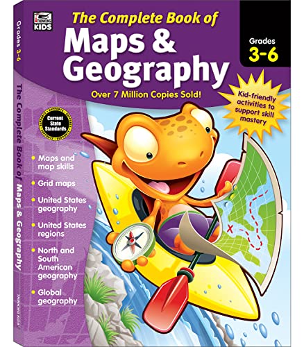
- 416 pages of map-skills activities
- Covers global and U.S. geography
- Includes review section and answer key
Best For: Grades 3–6 classroom or homeschool practice
Best for Younger Learners

- More than 50 colorful maps
- Introduces keys, compasses, and scale
- Includes facts, photos, and a map poster
Best For: Early elementary geography beginners
Best Wall Reference
National Geographic World Classic Map

- Waterproof and tear-resistant
- Flags, facts, boundaries, and terrain
- Includes useful thematic inset maps
Best For: Classroom or home world-map reference
Best Student Atlas
Merriam-Webster’s Student Atlas

- Colorful physical, political, and thematic maps
- Covers Earth science, climate, resources, and population
- Includes country facts, flags, charts, and a glossary
Best For: Grades 5–9 geography reference and classroom use
Best Hands-On Workbook
U.S. Geography & Map Skills Workbook

- Eight chapters for grades 5–8
- Hands-on maps, data activities, puzzles, and quizzes
- Includes an answer key and no-prep lessons
Best For: U.S. geography practice and map-skills development
Best Comprehensive Reference
National Geographic Concise Atlas of the World

- More than 250 maps, graphics, and illustrations
- Covers continents, countries, global issues, and space
- Large-format pages with a place-name index
Best For: Detailed world geography reference and research
Best Visual World Tour

- Lavishly illustrated world maps
- Covers geography, culture, and history
- Engaging choice for younger learners
Best For: Visual introductions to world geography
Best Classroom Atlas

- Designed for grades 6–12
- Maps, graphs, charts, and infographics
- Updated country reference section
Best For: Secondary-school geography coursework
Best Geography-and-Geopolitics Read

- Explains geopolitics through ten maps
- Connects terrain to national strategy
- Updated with current global events
Best For: Advanced geography and international-relations reading
Best Overall Atlas – National Geographic Student World Atlas
For students looking for map books for geography students, the National Geographic Student World Atlas offers a well-rounded reference for classroom study, college preparation, and independent exploration. It combines political, physical, and thematic maps with photos, facts, charts, and updated statistics.
Best For: Middle and high school students who need a broad world geography reference.
Pros:
- Includes political, physical, and thematic maps.
- Adds new thematic maps for every continent and updated infographics.
- Uses photos, facts, charts, and statistics to add context.
- Designed with help from a geography educator.
Cons:
- Its 144-page format may be less comprehensive than a larger reference atlas.
- Designed primarily for students in grades 7–9, so younger children may need a simpler atlas.
This is a strong all-purpose choice when students need both map reference material and accessible explanations of global places and issues.
Best Practice Workbook – Complete Book of Maps and Geography
Among map books for geography students, this workbook stands out for hands-on practice. It covers global, American, and U.S. regional geography while giving students exercises on coordinates, map types, floor plans, and time zones.
Best For: Grades 3–6 students in classrooms or homeschool programs who learn best through activities.
Pros:
- Provides 416 pages of practice activities.
- Covers population, political, climate, grid, and physical maps.
- Includes coordinate, floor-plan, and time-zone exercises.
- Has a review section and answer key for progress checks.
Cons:
- It is a workbook rather than a standalone visual atlas.
- The publication date is 2017, so it may not reflect the newest geographic information.
- Activities require writing or completing exercises, which may not suit readers seeking casual reference material.
This is a practical supplement for building foundational map skills, especially when a student needs structured repetition and an included answer key.
Best for Younger Learners – Children's Illustrated Atlas
For younger students comparing map books for geography students, the Children’s Illustrated Atlas makes world geography approachable through more than 50 colorful maps, photographs, icons, and bite-sized facts. It also introduces essential map-reading tools such as keys, compasses, and scales.
Best For: Children in the early elementary range who are beginning to explore countries, cultures, animals, and continents.
Pros:
- Includes more than 50 full-color maps.
- Combines maps with photographs, illustrations, and concise facts.
- Explores countries, cultures, people, animals, habitats, and landmarks.
- Includes a world map poster and comparisons of climates, populations, mountains, and rivers.
Cons:
- Its introductory approach may be too basic for older geography students.
- The 128-page format offers less depth than a secondary-level atlas.
- The listed reading range is younger than the grades 7–9 audience targeted by advanced student atlases.
This is an inviting first atlas for children who benefit from strong visuals and short explanations while learning how maps communicate information.
Best Wall Reference – National Geographic World Classic Map
For students who want a durable visual reference alongside their map books for geography students, this folded National Geographic world map provides detailed political and physical information in a compact format. It includes flags, country facts, place names, terrain shading, and inset thematic maps.
Best For: Students, classrooms, and travelers who need a reusable world map for quick reference.
Pros:
- Waterproof and tear-resistant for repeated folding.
- Shows boundaries, cities, physical features, rivers, oceans, and other water bodies.
- Includes country flags and facts such as capital, population, area, and GDP per capita.
- Adds inset maps for vegetation, land use, population density, and polar regions.
Cons:
- It is a two-page folded map, not a book with sequential lessons or activities.
- Its compact folded format may require unfolding a large 37.75-by-25.5-inch sheet for detailed viewing.
- It is less suitable for students seeking guided explanations or exercises.
This map works best as a durable companion reference, helping students quickly locate places and compare political, physical, and thematic information.
Best Student Atlas – Merriam-Webster’s Student Atlas
Merriam-Webster’s Student Atlas - Features Full-Color Physical, Political, & Thematic Maps
Check Price On AmazonFor families and classrooms looking for map books for geography students, Merriam-Webster’s Student Atlas offers an accessible introduction to physical, political, and thematic geography. It combines colorful maps with photographs, charts, graphs, country facts, and a glossary for middle school learners.
Best For: Students in grades 5–9 who need a broad world and geography reference.
Pros:
- Includes physical, political, and thematic maps.
- Covers landforms, climate, ocean currents, resources, and population density.
- Adds flags, country facts, photographs, charts, graphs, and a glossary.
- Includes new material on Earth’s and the atmosphere’s layers.
Cons:
- Its 132-page format provides an introduction rather than an exhaustive atlas.
- Designed for younger learners, so advanced students may want more depth.
This is a versatile starting point for geography study, especially when students benefit from visual explanations and quick-reference country information.
Best Hands-On Workbook – U.S. Geography & Map Skills Workbook
Among map books for geography students, this workbook is the practical choice for learners who need structured U.S. geography and map-skills practice. It combines short readings, real maps, vocabulary work, data activities, puzzles, writing prompts, quizzes, and an answer key.
Best For: Grades 5–8 students studying U.S. geography at home, in class, or through homeschool programs.
Pros:
- Builds skills through eight focused chapters.
- Includes latitude and longitude, regions, landforms, watersheds, climate, and population topics.
- Provides map activities, data exercises, puzzles, organizers, quizzes, and a final review.
- Includes a complete answer key and requires no preparation.
Cons:
- Focuses on U.S. geography rather than global geography.
- Its workbook format is less suitable for readers seeking an atlas-only reference.
This is a strong fit for students who learn by doing and need repeatable practice with maps, coordinates, geographic data, and written explanations.
Best Comprehensive Reference – National Geographic Concise Atlas of the World
For older students and families wanting detailed map books for geography students, the National Geographic Concise Atlas of the World provides more than 250 maps, graphics, and illustrations. It covers world regions, continents, the United States, country facts, current global issues, and selected space topics.
Best For: Students and families seeking a detailed world atlas for research and ongoing reference.
Pros:
- Offers more than 250 maps, graphics, and illustrations.
- Includes physical and political maps with continental data and country facts.
- Visualizes population, climate, health, and economic topics.
- Features moon, Mars, solar system, universe, and space-mission material.
- Large pages and a place-name index support detailed browsing and lookup.
Cons:
- At 2.95 pounds, it is less portable than a compact student atlas.
- The larger amount of detail may be more than younger learners need.
This is the strongest reference-oriented option in the group for broad world coverage, detailed cartography, and research topics extending beyond standard country maps.
Best Visual World Tour – Maps
Maps is a visually rich choice for readers looking for map books for geography students, especially those who learn through illustrated details. Its 112 pages cover borders, cities, rivers, peaks, cultural events, historical sites, plants, animals, and notable people from regions around the world.
Best For: Younger learners and families seeking an engaging introduction to world geography through large, illustrated maps.
Pros:
- Lavishly illustrated maps make geography approachable.
- Combines physical geography with cultural and historical facts.
- Broad world coverage in a visually appealing format.
Cons:
- Its broad, illustrated approach may not provide the depth needed for advanced coursework.
- It is less focused on current statistics, charts, or formal reference use.
Choose this book when visual exploration and curiosity matter more than a conventional academic atlas. The oversized format and wide-ranging details make it particularly suitable for browsing and foundational learning.
Best Classroom Atlas – Atlas of World Geography
For students who need a structured reference, Atlas of World Geography is one of the more classroom-oriented map books for geography students. The 2025 edition is designed for grades 6–12 and combines physical and political maps with graphs, charts, photographs, infographics, and an updated countries section.
Best For: Secondary students studying physical, human, and political geography with an atlas aligned to school-level topics.
Pros:
- Includes 85 pages of detailed physical and political maps.
- Covers plate tectonics, climate, environments, population, and economics.
- Updated country information includes flags, capitals, area, and population.
- Glossary and comprehensive index support research.
Cons:
- Its grade 6–12 focus may feel too detailed for younger children.
- The reference format may be less suitable for readers wanting a narrative geography book.
This is the strongest all-purpose pick for school use among these options. Its grade-specific design, thematic material, and reference tools make it practical for assignments, review, and ongoing classroom consultation.
Best Geography-and-Geopolitics Read – Prisoners of Geography
Prisoners of Geography: Ten Maps That Explain Everything About the World (Politics of Place)
Check Price On AmazonPrisoners of Geography takes a different approach to map books for geography students by using ten maps to explain how mountains, rivers, deserts, seas, climate, and other physical features influence political decisions. The updated edition connects geographic constraints to current international issues, including the Russia-Ukraine war, Israel-Gaza conflict, China’s regional ambitions, and shifting alliances.
Best For: Older students and readers who want to connect physical geography with geopolitics, history, and international relations.
Pros:
- Shows how physical landscapes shape geopolitical strategy.
- Uses ten regional maps to organize complex global topics.
- Updated discussion reflects current events and international tensions.
- Provides a deeper narrative complement to a traditional atlas.
Cons:
- Its geopolitics focus is less suitable as a basic map-reference book.
- The 464-page length and subject matter may be demanding for younger students.
- It emphasizes interpretation over broad map coverage.
Select this title when the goal is to understand why geography matters in world affairs, rather than simply identify places. It works especially well as supplemental reading alongside a conventional student atlas.
How We Picked These Map Books for Geography Students
We selected books that support practical geography learning rather than relying on maps as decoration. The lineup includes world and U.S. atlases, illustrated references, activity-based workbooks, folded reference maps, and books that connect geography with history and politics. We considered map coverage, clarity, age suitability, educational usefulness, and how well each title fits independent study, classroom work, or family learning.
Because students have different needs, this list includes both quick-reference resources and more substantial books. Check the product description for the latest edition, page count, recommended grade range, and whether the book is primarily an atlas, workbook, or general geography reference.
Quick Comparison
| Best For | Look For | Recommended Type |
|---|---|---|
| Elementary learners | Large illustrations, simple labels, and accessible explanations | Children’s atlas or introductory workbook |
| Grades 3–6 | Guided exercises, regional coverage, and map-skills practice | Geography workbook |
| Middle school students | Physical, political, thematic, and U.S. maps | Student atlas or U.S. geography workbook |
| Advanced reference | Broad coverage, detailed cartography, and current information | Concise or comprehensive world atlas |
| Geography and current affairs | Explanations of borders, terrain, resources, and political strategy | Analytical geography book |
Key Buying Factors for Map Books for Geography Students
Age and Reading Level
Choose a book that matches the student’s reading ability and schoolwork. Younger readers generally benefit from illustrations and short explanations, while older students may need denser labels, thematic maps, and more advanced regional detail.
Map Coverage and Variety
A useful student atlas should include political and physical maps, while thematic maps can add information about climate, population, resources, transportation, or language. A U.S.-focused workbook is a better choice when the assignment centers on states, regions, capitals, and national geography.
Practice and Usability
Workbooks are valuable when students need repetition, quizzes, labeling exercises, or guided activities. For frequent reference, prioritize readable typography, a logical layout, durable binding, and a format that lies flat or is easy to carry.
Edition and Currency
World maps and political information can change. For current-events study or long-term reference, favor a recent edition and verify the publication details before buying.
Who Should Buy Which Map Books for Geography Students?
Buy an illustrated atlas for a younger student who learns best through visuals and short explanations. Choose a geography workbook for structured practice, homework, or homeschooling. A student world atlas is the most versatile option for general classroom reference, while a U.S. geography workbook suits state and regional units. A concise world atlas works well for students who want broader, more detailed coverage without a large specialist reference book. For learners interested in geopolitics, a map-based analysis title can provide context that a conventional atlas may not.