The best historical map books turn geography into a clear account of how borders, cultures, trade routes, and political power changed over time. This roundup compares 10 strong options, from broad world atlases to focused studies of the United States, California, North America, and Europe.
Use the guide below to match the right book to your interests, preferred level of detail, and display or research needs.
Best 10 Historical Map Books Picks for 2026
Best Overall
History of the World Map by Map

- 140 maps spanning prehistory to the present
- Clear text panels, timelines, and illustrations
- Broad global coverage in a substantial gift book
Best For: Global history readers and map enthusiasts
Best U.S. History Atlas
Historical Atlas of the United States

- More than 500 historical maps
- Covers over five centuries of U.S. history
- Extended captions explain maps and historical figures
Best For: Detailed U.S. history research and exploration
Best North America Coverage
History of North America Map by Map

- Covers prehistory through the 21st century
- New maps paired with historical documents and artifacts
- Includes colonization, slavery, and abolition
Best For: Broad North American history study
Best State-Level History
Historical Atlas of California

- Nearly 500 maps and illustrations
- Covers 500 years of California history
- Includes rare maps, field sketches, and art
Best For: California history readers and map collectors
Biblical Timeline Pick

- Covers 6,000 years of biblical and world history
- Folds out to a 23-foot illustrated timeline
- Creationist perspective with color-coded panels
Best For: Homeschool, church, and Christian family use
World History Reference
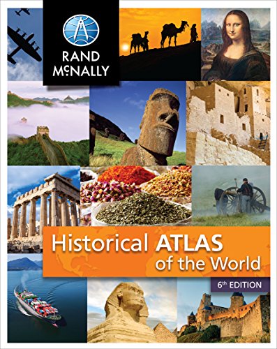
- Maps 5,000 years of world history
- Contains more than 100 thematic maps
- Compact 112-page student-friendly format
Best For: Grades 7–9 and general world-history reference
American Maps Showcase

- Explores the maps behind America's development
- Includes more than 150 color images
- Covers exploration, wars, and the Revolution
Best For: American history enthusiasts and visual learners
Best Illustrated Overview

- Explores 64 maps across global history
- Uses pull-outs and close-up details
- Connects maps with culture and power
Best For: Readers seeking a visually engaging introduction to cartography
Best American Map Collection

- Features 74 maps describing America
- Includes lengthy descriptions and illustrations
- Presented in a folio-format reprint
Best For: Readers focused on historical maps of America
Best European History Timeline
The Times Atlas of European History

- Covers 3,000 years of European history
- Uses maps to frame historical change
- Offers a focused regional perspective
Best For: Readers studying European history through maps
Best Overall – History of the World Map by Map
For shoppers seeking comprehensive historical map books, History of the World Map by Map offers a broad, visually rich survey from human prehistory to the modern era. Its 140 maps, timelines, illustrations, and accessible text panels make it a strong all-purpose reference and browsing book.
Best For: Readers who want a global overview of major historical events and movements.
Pros:
- Covers world history from 7 million years ago through the present.
- Includes 140 maps, timelines, photographs, and explanatory text.
- Large, giftable volume published in association with the Smithsonian Institution.
Cons:
- Its global scope means individual topics receive less depth than specialized atlases.
- At 5.73 pounds, it is more suited to tabletop reading than casual carrying.
This is the most versatile choice in the group for readers who want one substantial volume spanning ancient, medieval, early modern, and modern history.
Best U.S. History Atlas – Historical Atlas of the United States
This historical map book takes a detailed geographical approach to more than five centuries of United States history. With over 500 historical maps, extended captions, and coverage from early exploration through Hurricane Katrina, it connects changing maps with the nation’s expansion, conflicts, and development.
Best For: Readers wanting an in-depth, map-centered history of the United States.
Pros:
- Uses more than 500 historical maps from collections around the world.
- Covers exploration, settlement, wars, territorial growth, and technological change.
- Captions explain the people, motives, and historical context behind the maps.
Cons:
- Its focus is limited to U.S. history rather than global events.
- Published in 2006, so its coverage ends with Hurricane Katrina.
Choose this atlas when original historical maps and detailed geographic context matter more than a quick, lightweight survey.
Best North America Coverage – History of North America Map by Map
Among historical map books focused on a continent, History of North America Map by Map provides a chronological visual journey from the first human populations to the 21st century. Newly commissioned maps are paired with historical documents, artifacts, and timelines to make major eras easier to follow.
Best For: Readers studying North American history across cultures, colonization, and later political change.
Pros:
- Traces North American history from prehistory through the 21st century.
- Includes coverage of ancient civilizations, European arrival, settlement, slavery, and abolition.
- Combines new maps with historical maps, documents, artifacts, and chronological timelines.
Cons:
- The broad continental scope may not provide the depth of a state- or country-specific atlas.
- Its large format and 5.24-pound weight make it less portable.
This is a strong middle ground for anyone who wants more regional focus than a world atlas while retaining a wide historical timeline.
Best State-Level History – Historical Atlas of California
For a focused regional option in historical map books, Historical Atlas of California follows the state’s transformation across roughly 500 years. Nearly 500 maps and illustrations—from field sketches to commercial maps and works of art—support a concise narrative covering pre-contact California, the Gold Rush, and the present.
Best For: California history enthusiasts, local researchers, and map collectors.
Pros:
- Uses nearly 500 historical maps and varied illustrations.
- Follows California from before European contact through the Gold Rush and into the present.
- Features rare and unusual maps with explanatory captions and narrative.
Cons:
- Its tightly focused subject makes it less useful for readers seeking national or global coverage.
- Published in 2007, it is not a recent account of California’s history.
This lavishly illustrated atlas is the clearest fit for readers who prefer concentrated state history and original visual material over broad coverage.
Biblical Timeline Pick – Adams' Chart of History
For shoppers comparing historical map books with large-format visual timelines, Adams’ Chart of History offers a distinctive, creationist view of 6,000 years of biblical and world history. Its 21 fold-out panels can be read as a book or opened into a continuous 23-foot timeline.
Best For: Christian families, homeschoolers, church libraries, Sunday school settings, and buyers seeking a display-oriented history reference.
Pros:
- Covers biblical and world history from 4004 BC through the dawn of the 20th century.
- Displays nations, kingdoms, people, events, inventions, and literary works side by side.
- Uses full-color illustrations, labels, and color-coding across 21 panels.
- Heavy-duty matte cardstock and hardcover protection support storage and display.
Cons:
- The creationist viewpoint may not suit every reader.
- Its 23-foot open format requires substantial display space.
- It is a visual timeline rather than a conventional narrative history book.
This is the most presentation-focused option in the group. Choose it when an at-a-glance biblical and world-history overview matters more than portability or extended prose.
World History Reference – Historical Atlas of the World
Among historical map books, the Rand McNally Historical Atlas of the World is a compact, classroom-friendly choice. It uses more than 100 thematic maps to present major periods and turning points across 5,000 years of world history.
Best For: Students in grades 7–9, general readers, and anyone wanting a concise world-history atlas for study or reference.
Pros:
- Covers 5,000 years of world history.
- Includes over 100 thematic maps.
- Focuses on important historical periods and turning points.
- Compact 112-page format is suited to classroom or home reference use.
Cons:
- Its 112 pages provide less room for detail than a larger historical atlas.
- The focus is broad world history rather than a specialized regional topic.
- It is designed for grades 7–9, which may limit its fit for advanced readers.
This is the practical all-purpose pick for readers who want map-based historical context without the size of a coffee-table volume or the specialized viewpoint of a timeline chart.
American Maps Showcase – Mapping America
For readers seeking historical map books centered on the United States, Mapping America combines narrative history with more than 150 color images. It uses hand-colored maps, engravings, paintings, photographs, and diagrams to explore exploration, settlement, wars, and the making of America.
Best For: American history enthusiasts, visual learners, collectors, and gift buyers who want an immersive, richly illustrated volume.
Pros:
- Focuses on the exploration and development of the United States.
- Features more than 150 color images, including period maps and engravings.
- Covers Renaissance exploration, the Golden Age of mapmaking, the Indian Wars, and the American Revolution.
- Combines scene-setting text with maps, artwork, photographs, and diagrams.
Cons:
- Its American focus makes it less suitable as a general world atlas.
- The richly illustrated 288-page volume is heavier than a compact classroom atlas.
- Readers seeking detailed modern cartography may prefer a more technical reference.
This is the strongest choice for a visual exploration of American history through primary-era maps and artwork. It offers more narrative and image depth than a basic map reference, but it is not intended as a broad global atlas.
Best Illustrated Overview – Great Maps
Great Maps: The World's Masterpieces Explored and Explained (DK History Changers)
Check Price On AmazonFor readers comparing historical map books, Great Maps offers a broad, visually rich survey of 64 maps from around the world. It follows cartography chronologically, explains the stories behind the maps, and uses pull-outs and graphic close-ups to examine important details.
Best For: History and geography enthusiasts who want an illustrated introduction to maps, cartographers, exploration, and the cultural context surrounding mapmaking.
Pros:
- Covers 64 maps, from medieval Mappa Mundi and early atlases to Google Earth and maps of the moon.
- Explains why each map was created, its intended audience, and how it was made.
- Connects cartography with navigation, propaganda, power, art, and politics.
- Includes visual analysis, pull-outs, and graphic close-up details.
Cons:
- Its global scope means individual maps receive a selected rather than exhaustive treatment.
- At 3.75 pounds and roughly 10.31 by 12.2 inches, it is a substantial coffee-table-style volume.
Choose this title if presentation and broad historical context matter as much as map coverage. Its chronological structure and strong visual emphasis make it an accessible starting point for exploring the history of cartography.
Best American Map Collection – A Book of Old Maps
Among historical map books, A Book of Old Maps takes a focused approach to maps describing America. This reprint presents lengthy descriptions and illustrations of 74 important maps, making it a specialized choice for readers interested in American map history.
Best For: Readers seeking a dedicated collection of historically significant maps of America with substantial accompanying descriptions.
Pros:
- Focuses specifically on maps describing America.
- Features descriptions and illustrations of 74 maps.
- The folio format suits readers interested in a substantial map reference volume.
Cons:
- It is a 1969 reprint rather than a newly published edition.
- The supplied copy is described as having rubbed covers, hinge and spine wear, and a small snag on the front cover.
- The notes do not provide a detailed historical overview beyond the individual map descriptions.
This is the more narrowly focused option in the roundup. Its appeal lies in the concentration of 74 American maps and their descriptions, while buyers should pay close attention to the listed condition of the reprint copy.
Best European History Timeline – The Times Atlas of European History
The Times Atlas of European History is a compact choice for readers comparing historical map books around a clearly defined region and time span. Its subtitle promises 3,000 years of European history in maps, making it suited to readers who want history presented through geographic change.
Best For: Readers interested in a map-based overview of European history across a 3,000-year timeline.
Pros:
- Focuses on European history rather than global cartography.
- Covers a broad 3,000-year historical span.
- Presents the subject through maps, offering a geographic framework for historical change.
Cons:
- The supplied details do not specify the number of maps or provide examples of individual map topics.
- At 208 pages, it may provide less visual or textual depth than a larger reference work.
- Published in 1994, it is an older edition.
Consider this atlas when European history is your priority and you prefer a long chronological sweep. Its regional focus distinguishes it from broader world-map surveys and America-centered collections.
How We Picked These Historical Map Books
We selected books that use maps as a central way to explain historical change rather than treating them as decorative illustrations. The lineup includes comprehensive world histories, regional atlases, chronological references, reproductions of older cartography, and accessible visual overviews. We also considered geographic coverage, historical range, map quality, explanatory text, and how useful each title is for casual reading, study, or reference.
Because map books vary widely in purpose, no single title is ideal for everyone. A richly illustrated overview may be better for browsing, while an original-map atlas can be more valuable to researchers, collectors, or readers interested in cartographic evidence.
Quick Comparison
| Best For | Look For |
|---|---|
| Global history | World-spanning timelines and maps covering multiple eras |
| U.S. history | Original maps showing territorial growth, settlement, and political change |
| Regional study | Focused coverage of North America, California, or Europe |
| Visual browsing | Large reproductions, color plates, and concise explanations |
| Chronological reference | Parallel timelines, dated maps, and consistent historical sequencing |
Key Buying Factors for Historical Map Books
Geographic Scope
Start with the region you care about most. World atlases provide context across civilizations and empires, while regional books usually offer more detail on borders, settlements, institutions, and local developments.
Historical Coverage
Some titles begin with ancient history and continue into the modern era; others concentrate on a particular country or period. Check the time span if you need coverage of colonial expansion, revolution, state formation, war, or contemporary borders.
Map Style and Accuracy
Look for clear legends, readable labels, useful scale, and explanations that identify what changed between maps. Reproduced historical maps can provide valuable primary-source context, but they may use outdated names, inconsistent projections, or dense typography.
Reading Format and Physical Quality
Large-format books are often easier to study and more impressive on a coffee table, but they can be heavy and less portable. If you plan to annotate or consult a title frequently, prioritize legibility, binding, paper quality, and a practical page layout.
Who Should Buy Which Historical Map Books?
Choose a broad world-history title if you want one accessible introduction to the development of societies, empires, and borders across the globe. A United States or California atlas is a better fit for genealogy, local history, American studies, or research into territorial change. North America-focused coverage works well for readers interested in Indigenous nations, colonization, migration, and the relationships among neighboring countries.
Readers who value primary visual evidence should consider books built around original or reproduced maps and engravings. A chronological atlas is especially useful for students and researchers who want to follow change in sequence, while a curated collection of major maps suits readers who prefer shorter explanations and high-impact illustrations. Collectors and design-conscious readers should pay close attention to image reproduction, binding, trim size, and whether the book is intended for display as well as reference.